hiking trails of duxbury
whiton woods

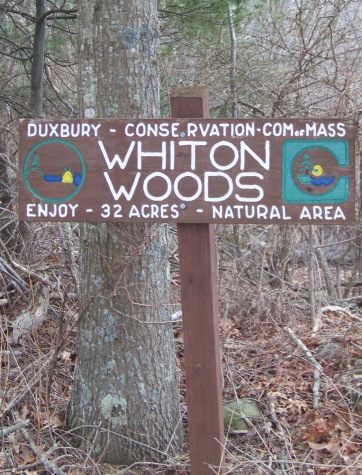
Of the hiking trails of duxbury, whiton woods is an area that
I had previously passed by many times and never noticed.
Across from a working cranberry bog, that most likely
took my attention while driving down Temple St,
whiton woods is tucked slightly back into the forest.
Located on temple st. along a stretch that is sandy at the side of the road making it a great place to park.
The sign sits just enough away from the road to not be noticeable unless you are looking for it.
This may be one of the reasons for the peacefulness of the area. On my excursions here I have not met anyone nor seen the usual trash that one finds with an area well visited.
The hiking trail runs along side of a private residence into the forest and along a cart path into the 32 acres that make up this property.
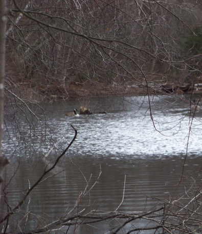
Views of a pond that fronts Temple street can
be found on the first part of this hike.
Many ducks and geese flock to the
ponds and stream here.
There is one main trail through the forest that is marked and another route that is not marked and travels over private property that is not posted.
This wooded area is one of many areas on the South Shore that seem to have pre-existing cart paths before the conservation area was set aside.
Most of these were from colonial days and sometimes even before that.
There appear to be two cart paths that run the length and beyond Whiton Woods on either side of the property.
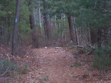
The hiking trail through the conservation property is marked with a bright blue rectangle following a wide level cart path.
Soon at 1/10th of a mile a narrow path will lead off to the left. This is the end of a loop that the main trail makes. I chose to continued straight ahead.
Shortly after this intersection another wide trail will lead to the right.
This is the alternate trail through the area that leads over private property.
It will follow a narrow strip of land along a bog pond and behind the pond that fronts Temple St. It is best to stick to the main trail first till you get to know the property.
As you continue straight, better views of the bog pond open up and much evidence of rough past winters show itself with many fallen pine trees.
At just over 1/3 mile, the main marked trail takes a left and follows a much narrower trail across the property.
The original cart trail continues straight ahead. If you follow that, it leads into yet more private property. If you do continue straight to "investigate", you will find narrow trails that lead off to the right. One goes out to the Marshfield Country Club golf course.
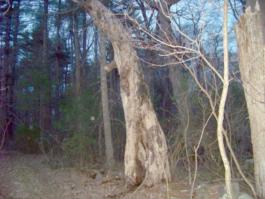
This cart path that goes straight will also bring you through an old stone wall where a very interesting old tree remains.
Way more interesting than in this picture!
Further along the way on the cart trail you will pass by a vernal pool in spring and winter seasons. To learn more about vernal pools and ponds visit my page about Elfin Pond Trail in Holbrook.
Back at the main hiking trail having followed the markers and taken the left the trail will eventually pass through a stone wall of it's own, possibly another portion of the one on the previous cart path. This one well intact. Here I found evidence that horses use the property.
Shortly after this the trail connects with the other cart path through the property. The trail now goes left. Along the right of this trail a marsh can be seen. Shortly down the trail the water that feeds this marsh draws close to the cart path.
For a short distance the trail turns left and runs a bit up hill toward a rocky outcrop. Many smaller faint trails can be seen as others investigated the group of boulders that form the outcropping.
On the cart path it appears this incline was to avoid an area of several fallen trees from the past. The area is no longer a problem but the trail is well defined going up hill and around the former trouble spot.
The trail winds its way through the forest to reconnect with the original cart path but first makes its way through another massive fallen tree area.
This official marked route through Whiton Woods is just slightly over one mile.
another hiking trail route through whiton woods
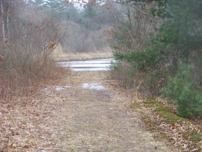
The other hiking trail route uses
the cart path that leads between
the pond and bog.
There are no posted signs here but it
seems that this may be private property
that allows others to traverse to other
parts of the whiton woods trails.
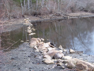
Rock wall through a pond!
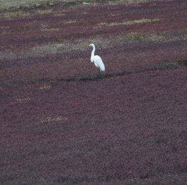
Following the wide road like
path will lead you out to a
working cranberry bog.
My early morning hike
rewarded me with this sight!
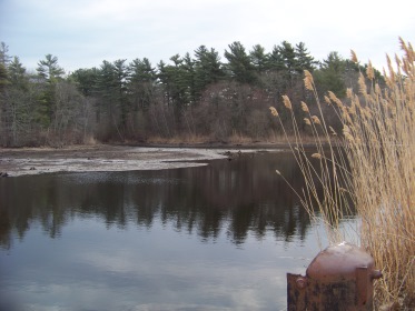
Keeping to the left of the cranberry bog,
and heading to the other side of this bog
will bring you to a dirt road.
Along the way better views of the bog pond
and a stream leading out of it can be seen.
The road leads out to a field that looks like it may have been a cranberry bog as well. Along the way is a side loop that will bring you close to the stream that leaves the bog pond.
Partially blocked by bent trees. Both come together at the field. Across the field the golf course comes into view again.
Keeping to the left and following along the edge of the field a trail into the woods comes in sight.
This follows along shortly to a marsh area that the stream feeds into.
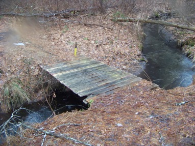
Following through the forest
the trail runs along the top of
glacial impressions and then leads
down to a stream crossing over a little bridge.
Stay on the trail, soon signs of posted land will appear.
This leads to one of the paths that connect with the original cart path into the property.
If you explored the main part of the property first it will start to become familiar.
Once out on the original cart path, take a left.
This will bring you back to the front of Whiton Woods.
This route was approx. 1 1/2 miles
- South Shore Hiking Trails ›
- Duxbury ›
- Whiton Woods
Trail
Quick Facts
Directions:
from route 3 take exit 22 heading east on route 14 (congress st). Follow around roundabout to other side. At the fork in the road go to the left on Church St. (route 14 turns to the right). At the next intersection go left on Temple St. Continue on Temple about 1-1/2 miles through intersection with Lincoln and Franklin Sts. Whiton Woods is on the right.
Parking:
Sandy area along roadside.
3-4 vehicles
Trail Time:
variable: short to moderate
Difficulty:
Easy
Water sources:
ponds and a stream
Other activities:
bird watching, x-country ski on cart paths,


New! Comments
Have your say about what you just read! Leave me a comment in the box below.