hiking trails of plymouth
Plymouth Harbor Breakwater

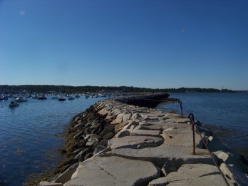
When hiking trails in Plymouth, hiking the Plymouth Harbor Breakwater is a great addition to visiting the waterfront area.
If you are planning a journey hiking the trails in the area, and the Sea side trail is marked as the beginning, adding the 1/2 mile to the breakwater and hiking it's length is a great way to get a full day of hiking in.
What is great about the area is that if 4 1/2 miles of hiking trails is a bit too much in one day, this hike can be broken up or made an all day affair by adding stops along the way.
There are many benches and picnic tables or another option is lunch along the way at the many cafes or restaurants found in the center of Plymouth or right along the way to the breakwater.
The Plymouth Harbor Breakwater is 3500 feet
in length having two leg portions.
The first leg is 1400 feet long heading to the east.
It then turns for the southeastern leg portion totaling 2100 feet.
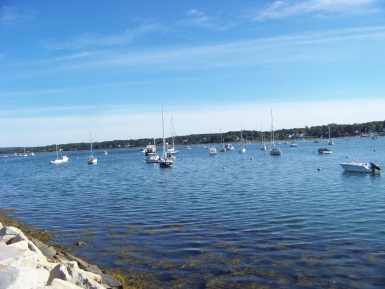
Breakwaters are constructed to protect
the harbor and provide safe anchorage
for the boats moored in the harbor.
While Long Beach to the east of the harbor no doubt provides some protection, the breakwater completes the job.

My hikes of the Plymouth Harbor Breakwater have started with the hike of the Sea Side trail which ends at Nelson Playground located at the turn on Nelson st and Water st.
If your exploration does not include that trail, parking at the playground is one option.
Another is to continue on Water St for the public parking closer to the breakwater and restaurants a short distance away.
From Nelson Playground you have one or two options depending on the tide. If the tide is high, continuing the hike along the street is the best route.
At low tide I have found walking along the beach the better option and far better than asphalt and street traffic.
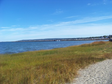
The 1/2 mile hiking trail to the start of the Breakwater is at times buffered by sea grass along the way.
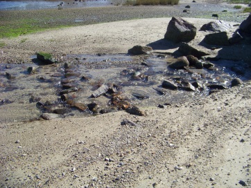
If the tide is still receding there may be outlets of water still draining.
Very pleasant to walk through on a hot day!
Plenty of beach for those with dogs to come to for a swim.
As I passed the public parking area there was rocky beach that looked perfect for a kayak launch. On another day I did enviously watch as some kayaked by!
As you come off the beach area there is a walkway to lead you to the breakwater. Along here are benches.
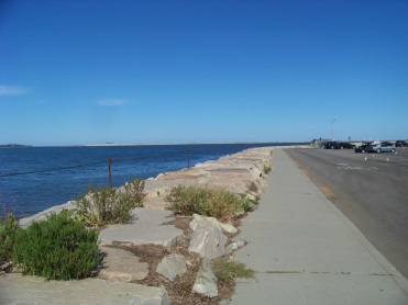
There at the corner of where the restaurants in the downtown area start, to the side of the parking, the breakwater begins with it's huge boulders.
Walking along these requires ones full attention.
There are sizable gaps between the boulder that if a misplaced step was taken, most certainly would end with a broken or at least sprained ankle.
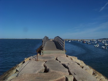
After it runs the length of the parking lot and along the Leo Demarsh Boat Ramp, there is a small bridge to cross over.
Once over the cautious stepping resumes on the large boulders of the Breakway.
There
are posts with a cable to grab hold of but at places the cable is on
the ground and for a short distance the posts are vacant.
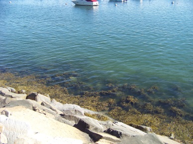
Along the way one
noticeable feature
is the very clear
green water at the
breakwaters edge.
On a summer or early fall day many sea faring birds can be spotted. Heron are a pretty common feature.
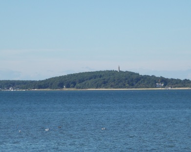
Looking to the left the Myles Standish Monument on Captains Hill in Duxbury is a clear sight.
Looking
directly forward (on the first leg) Long beach looms ahead.
Off in the distance to the left of Long Beach are Saquish a peninsula off of Duxbury beach that is in Plymouth's boundary and Clarks Island. The Pilgrims went to Clarks Island first before coming on shore.
On the way out to the Breakwater's end point there may very well be a bevy of fishermen enjoying the breakwater as well.
The
total mileage each way on the Breakwater is .78 miles making it 1 1/2
miles in total.
The boulders that make up the breakwater are sloped on the sides and make a nice resting spot at the end point.
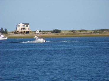
This end point is a great spot to watch harbor traffic!
- South Shore Hiking Trails ›
- Plymouth ›
- The Breakwater
Trail
Quick Facts
Directions: from route 3 take exit 15A heading east on Samoset St. At the intersection with 3A go left for the Nelson St playground. Nelson St is the 5th right. For the downtown public parking, head straight at the 3A intersection. At the rotary head north on Water St. Large parking lot on right. In off season the Leo Demarsh boat launch area has plenty of parking as well.
Parking:
extensive parking lots
Trail Time:
light to lengthy depending on trail options
Difficulty:
Moderate: walking is easy stepping choices made carefully.
Water sources:
only sea water or purchased water at stores and restaurants
Other activities:
bird watching, kayaking, fishing
Cautions: those with balance issues may not want to hike here.
There is almost always a good breeze here. In cool weather extra protection needed.
In summer this is a full exposure hike. Lots of sunblock!!!


New! Comments
Have your say about what you just read! Leave me a comment in the box below.