hiking trails of hanover
Fireworks Trail

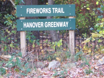
Of the many hiking trails of Hanover the fireworks trail is one of the more lengthy.
This hiking trail is located across the street from the newly designed Forge Pond Park on King St. Plenty of parking here as well as walking and recreation of all sorts.
Signage at the beginning confuses me.
Perhaps it is older and the trail has been added to since?
It claims hiking length of 30 minutes. I'm not sure what they mean by length where as the route of this trail is that of a large loop.
It took me about 2 hours to walk the "whole length".
It also claims a granite seat as the point of interest??
Don't know where that is.
In my opinion the three bridges, two ponds and the Drinkwater River are pretty interesting points of interest! (Thinking this info was placed in the wrong area and belongs elsewhere.)
The trail starts off looking somewhat like
a driveway of sorts with boulders lining
the end of it and some very nice looking
cast iron fencing.
After the boulders the hiking trail begins.
If you look to your right the other end of the loop emerges here.
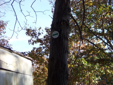
During my first hike here at the fireworks trail,
I did not even notice this end! The culprit?
The green arrows that direct your attention
straight ahead and mark the hiking trail throughout.
It's the best route anyway!
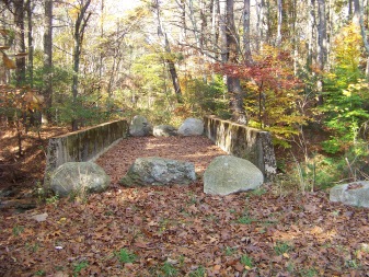
The narrow path leads through the woods and not long after, you will find yourself at a cement bridge that looks like cars may have traveled over it in days past. There are boulders blocking both sides to prevent that now.
If you look carefully to your left you will notice an arrow pointing to the right. I did not notice this either on my first visit here. (The arrow is positioned rather high). After the bridge you find yourself on the outer boundary of an industrial area.
I thought the route then ran along the back of this property. Actually the trail takes a sharp right and follows another narrow path that runs along Drinkwater River.
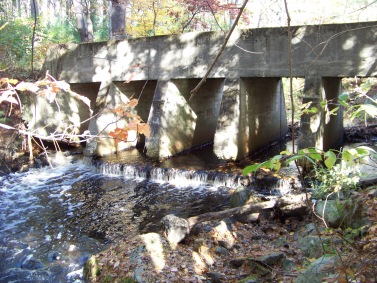
I found this to be the most interesting and scenic part of the hike. Looking back at the bridge you just traversed you can admire the construction of it.
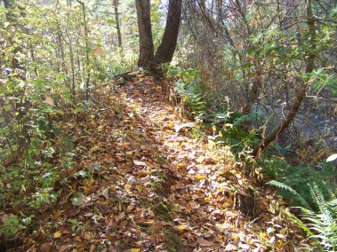
The path along the river runs on a ridge fairly high above the river for a bit of a distance.
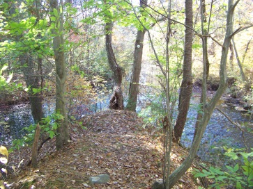
Then the hiking trail takes a sharp left. At this point another stream enters here. Very scenic!!
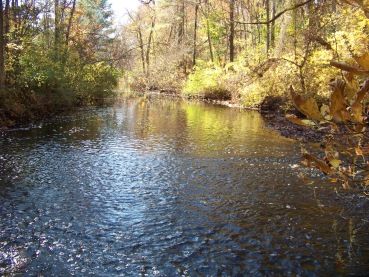
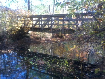
Shortly after the sharp turn the trail runs over a wooden bridge that does not appear to be very old. There is a trail that continues on straight ahead past the bridge before crossing it.
This, if followed will take you alongside a small pond on the left where many duck seem to reside. The trail will follow into the industrial park at another end.
Once over the bridge the fireworks trail leads back, once again, along side the river on a narrow path. It will then lead away to the left and follow behind the Hanover DPW. After passing that, the trail will enter the forest again becoming a cart path. Now, it will run near the river again, but not as close as it previously did.
The river soon opens up to Lily Pond.
The bit of forest between the hiking trail and the river or pond here is thick with briars giving it a more secure feeling for the many water fowl that reside here. Most times you can here lots of activity on the water, but unfortunately cannot see through the thicket between.
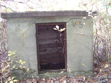
Soon you will start to find evidence that this was the property of the National Fireworks Company. Many small abandoned storage sheds start popping up along the paths.
Your journey around now comes to a junction and leading left. You will follow along a strip of land (the first of several) that is lined by water on the right (upper part of Factory Pond) and a marsh to the left of the trail.
At the end of this portion, the trail takes a right and follows behind a construction company (very noisy on week days). There is a dirt road to the left that will take you out to Winter St.
I believe this is the route of the " continuous Hanover Greenway" where you can follow through a residential area and to the Myrtle Street Trail.
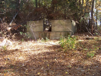
More evidence can be found here of the National Fireworks Company.
From
records that describe how work was done here, it is easy to recognize
this was a main manufacturing area. The company started as a
recreational fireworks company, but in time of war they were used to
build munitions.
Many of the "ingredients" or supplies used were kept separately in several small buildings. Many of these remain and dot the property throughout
This separating was not only for safety but for security purposes as well.
From what I read about the daily routine here, workers were
generally busy transporting materials from the many storage units to a
main building that only a few had access to. The average employee did
not have access or knowledge of how the finished product was produced.
It sounds like this was a very active outdoor job.
The hiking trail at this junction takes a right with arrows leading the way, only problem, they should be pointing up to indicate straight, but they point to the left. It becomes obvious that there are no turns as there are no paths to the left. The cart path opens up to full roadways. Factory pond comes into full view here.
Once past the construction company the trail once again becomes a cart path. The discouraging part about this hike is that it becomes obvious that this has been used by many as a dumping area for unwanted items such a television sets and building materials.
The trail will take a left and then shortly thereafter intersect and follow along a dirt road to the left. (This road is where many access the area to dump, it should be gated to limit this activity.)
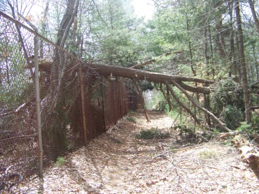
The hiking trail will shortly lead to the right once again into the forest up a hill to a boundary line which is fenced. The trail leads right yet there is a portion going to the left that goes out to the street. There are several other paths here leading off to the left that criss cross the property. The arrows seem to be missing on this portion of the property. Staying on the "road" like portion along the fence is the most direct way. The road will come down to yet another boundary and another fence blocking access to Factory Pond on the other side .
Leading to the right, another marsh will soon appear on the right, and you will be once again on a strip of land between pond and marsh. In early spring this area is alive with wildlife activity. Birds and frogs will be serenading you!!
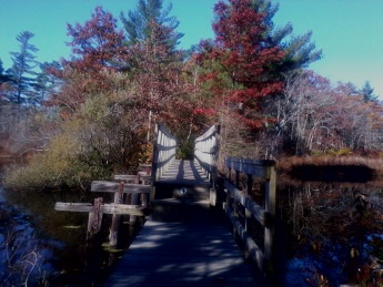
The trail will take another turn to the right and follow out to a road where yet more trash is present. This was the most appalling and disturbing part of my hike.
At this point the trail goes to the left and follows over a bridge over a narrow part of Factory Pond. The trash was so disturbing to me that I failed to notice the Blue Heron perched on the bridge that lifted away as I approached.
This should have been the great culmination of my hike but the trash marred the experience!
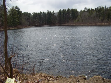
View of Factory Pond before the bridge over it. Across the pond is the town of Hanson.
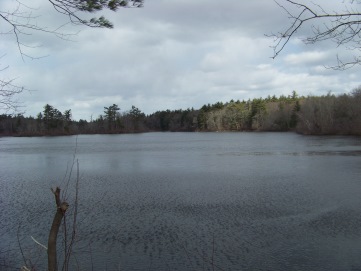
Looking out over Factory Pond to the North after crossing the bridge.
Once over the bridge the trail again becomes a cart path.
For the final time the journey becomes a strip between marsh and pond.
You will yet again be following alongside the boundary of the property.
This portion is rather long with some limited views of Factory Pond.
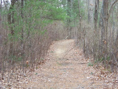
Drinkwater river will appear on your right after passing above the pond. This will only be seen in weather without foliage. When there is leaf coverage you will be too far from the river to notice it.
There will be one more turn to the left and the trail will complete it's circuit where you started your journey.
- South Shore Hiking Trails ›
- Hanover ›
- Fireworks Trail
Currently the Fireworks Site is involved in a clean up effort. Having been a munitions and manufacturing site in previous years, many environmental concerns arose and are now being addressed.
A portion of the trail loop is closed.
Trail
Quick Facts
Directions:
from Boston take route 93 south and route 3 at split. Take exit 35. At end of ramp take right on to Hingham st. into Rockland. At end take right at lights onto Webster st. Follow to first intersection with Liberty st taking a left. At end take left on Market. This will become Hanover st at line. At lights take right on Circuit. Take right on King st. Forge Pond Park will be on the right.
Parking:
At Forge Pond Park
Trail Time:
Moderate;
11/2 - 2 hours
Difficulty:
Easy
Mostly flat and level
Water sources:
Drinkwater River, Lily Pond, Factory Pond
quality of water questionable!!



New! Comments
Have your say about what you just read! Leave me a comment in the box below.