hiking trails of whitman
Donald Flaherty Trail

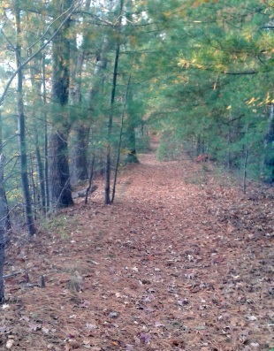
This was a surprising find among hiking trails!
An unassuming little trail along wetlands.
The sign announcing the property blends well into the landscape.
Surely, many people including myself drive by this little gem without ever seeing it!
The trail begins on Auburn St near the
intersection with Washington St.
The sign to the property is a faded
polished wood that blends into
the landscape.
The beginning of the trail at this point is narrow and
bit overgrown leading to the hidden quality of the property.
Once past this though, the hiking trail opens up to cart path sized.
Shortly up the trail a flat rock will be found on the right.
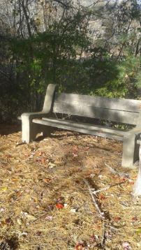
At first I thought this would be a good spot to sit at till shortly up the trail at .16 miles on the same side, this bench appears.
Just before the bench on the left, the marsh this trail runs along opens up.
The bench is at a good spot for viewing this hidden wetland and the wildlife that live here. My first visit here I noticed a Blue Heron lift away from a lonely branch of a leafless tree in the marsh.
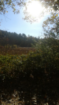
At 1/4 mile the trail passes over a culvert with a bit of wetland now on the right as well.
At .29 the trail starts to pull away from the wetland on an elevated area.
The land below on the right looks like blueberry bushes.
At .38 the trail now runs behind homes on a side street off Harvard St.
Just before 1/2 mile a downed tree causes a trail loop through the forest to the left.
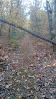
Many bat houses have been installed on trees on this part of the trail.
Shortly after, another downed tree, this one easily passed under.
At just after 1/2 mile the trail comes to an intersection.
To the right, the trail leads to the St. James Cemetery on Harvard St.
Another trail here goes to a private residence, the trail fades before doing so.
To the left at this intersection, a short trail leads to a clearing with a fire ring.
Continuing on the main trail, just after the intersection, an alternate route on higher ground leads on the left.
Most likely used in the spring when wet trails are a high probability!
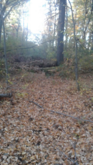
At .69 miles a very faint almost unnoticed trail leads to the left.
If followed will become more established looking but leads to posted land and the one stream through this part of the land.
At just short of 3/4 miles the trail ends rather abruptly with a pile of logs.
There are other faint trails to the right that lead to private property that I was hoping would lead out somewhere on Harvard St., no such luck.
There seems to be plenty of room to add a small loop trail here though?!
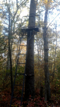
Near the end of the trail I found pink ties leading through the forest.
Hoping this was an early marking of further trail development, I followed them.
They lead to this...... deer stand.
Not sure if this is on the conservation property or private land.
Not the first deer stand I've come across, this one is fairly new.
Many hunters leave them standing for other seasons or other years.
I find them great for bird viewing or animal watching.
I usually use google maps when I explore a new area.
Here, I knew there was a stream in the area.
(Something feeds the wetland!)
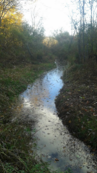
From the deer stand I bushwhacked to the stream.
Along the way I found the other end of the "faint trail" near the end on the left of the Flaherty Trail.
I would have never seen this trail or found it's existence without exploring!
Or found this enchanting part of the stream that leads out to the wetland.
Not sure if this stream has a name, but seems to be the one that connects to Meadow Brook.
- South Shore Hiking Trails ›
- Whitman ›
- Flaherty Trail
Trail
Quick Facts
Directions:
Use exit 38 on route 3 follow south on route 18 into Whitman. At the intersection with route 14 take a left. Follow straight til just before the intersection with Washington St where route 14 takes a right. Trail head will be on the right.
Parking:
Along side the road.
There appears to be a carved out stone filled spot for one car, have not determined if this is for trail use or private.
Trail Time:
Short:
3/4 mile trail
Difficulty:
Easy
Water sources:
Limited: water through culvert
Other activities:
Bird watching
snow shoeing


New! Comments
Have your say about what you just read! Leave me a comment in the box below.