hiking trails of weymouth
Bradford Torrey Bird Sanctuary

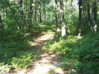
The hiking trails at the Bradford Torrey Bird Sanctuary are located in South Weymouth.
Not far from one of it's borders is Route 18, previously the sanctuary was not accessible here but now features the main entrance to the property.
This new trail head although the most convenient parking for the Sanctuary is a bit of a challenge at high traffic times. It may even be safer to locate the parking and then turn around on route 18 making the turn into the parking area a right turn.
Other borders are Park Ave, Pleasant St. and many of South Weymouth's larger apartment communities making this slice of secluded forest close to some very busy areas of this town.
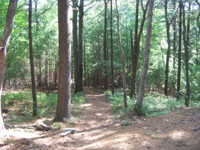
Yet once inside the sanctuary's borders it is a strikingly serene place filled with the chatter of birds and scampering wildlife.
On my previous visits here twice I disturbed deer browsing the bushes!
This once overlooked and neglected area known to many but difficult to find or access, has been cleaned up and turned into a well used treasure.
Previous visits I never encountered a soul here beyond the wildlife that live here.
Navigation through the sanctuary is now organized. Hiking here you will find new color blaze markings and a map at all trail heads. Each of these trail heads have been widened and are easy to find.
The sanctuary being filled with birds is testament to the man the property was named after. It is almost as if they know this place was set aside for them.

Bradford Torrey 1843-1912 grew up in and graduated from Weymouth. He was a writer specializing in outdoors and travel. He is greatly responsible for making the "nature ramble" popular as well as the past time of bird watching.
Nature rambles are a combination of walking and talking about nature. It is suggested but never documented that Torrey's childhood days in then rural Weymouth were filled with this activity. He was not just a casual birdwatcher but an ornithologist, one who studies birds intently subsequently writing many papers on the subject.
He wrote for several ornithological publications and wrote a book called "Birds in the Bush". Other books he wrote are A Rambler's Lease (1889), The Foot-Path Way (1892), A Florida Sketch-Book (1894), Spring Notes from Tennessee (1896), Footing it in Franconia (1901), Friends on the Shelf (1906) and Field-Days in California (1913) posthumously published.
Though some of these titles suggest someone who may have liked the natural world as promoted here in south shore hiking trails, Torrey did not like travel in the forest during his writing career. He preferred the urban setting and liked to help those who lived in the city to "see" nature even in this setting. So maybe the crazy suburbia right outside the sanctuary isn't so crazy after all!
Hiking trails at the Bradford Torrey Bird Sanctuary
My first visit here, I thought this was a small area with a few hiking trails, not much to write about. My initial exploration of the property I found myself on trails ending at private property. Though there were several trails that still needed to be explored.
Snap judgement as my next visit established! Taking the "other trail" at an intersection from my first exploration brought me to another portion of the forest that seemed to endlessly continue with side trails leading off to places that I needed more days than I had in supply, to continue exploring this grand property!
What I found is that Bradford Torrey Bird Sanctuary is a place that one could spend a considerable amount of time at. There are trails to more rugged terrain. Lots of rocky outcropping, cart path wide trails that mountain bike enthusiasts would most likely well appreciate and more intimate trails leading through grassy glens and thicker forest.
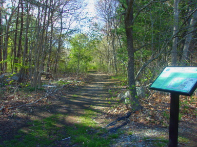 The easy to find widened entrance from the high school
My initial point of entry was from the rear of South Weymouth's high school. On the road that leads around the back of the school there are a few parking spaces where trails to the property emerge. In the past the fall, winter and early spring these trails were easily seen. However once summer came the foliage that springs up blockaded the trail. That is a thing of the past! This area has been widened out and easy to find.
The Updated Hiking Trail description
Since my initial description of this property, the new trailhead as well as the additional trailheads were made. There is much more organized navigation here as well.
My description will now start from the Main St trailhead now called the Mary Ellen Schloss trailhead (rt 18).
The trail system is now consisted of two colored blazes. Yellow rectangles for the loop trail that circles the sanctuary and blue rectangles for trails that traverse across the sanctuary and those that lead off to the other trailheads.
There are other smaller unmarked trails leading to private property.
My description will only be of the yellow loop trail leaving the other trails for the visitor to explore.
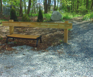 The beginning of the Mary Ellen Schloss Trail Head.
From the Mary Ellen Schloss Trailhead the path starts wide and easy. Along the way is a patch of garlic mustard. This is considered an invasive species read about it and why it needs removal.
Soon after the trail passes over a bit of sunken rock wall and shortly takes a steep dip down and up again in a glacial depression.
This trail head is marked by blue blazes that shortly end and the trail connects with the yellow blazed loop trail.
Going right the trail is not as wide but not narrow. At .25 of the journey one of the inner blue blazed trails takes a deep left. Now at mid still early spring a vernal pool can be seen to the left through the trees.
Shortly after a faint trail leads to the right. The trail runs low and a bit wet during the rainy season and then climbs. Another trail leads to the right. The trail now turns rocky. Quite often below the yellow blaze the silver dots that were used for navigation in former times appear.
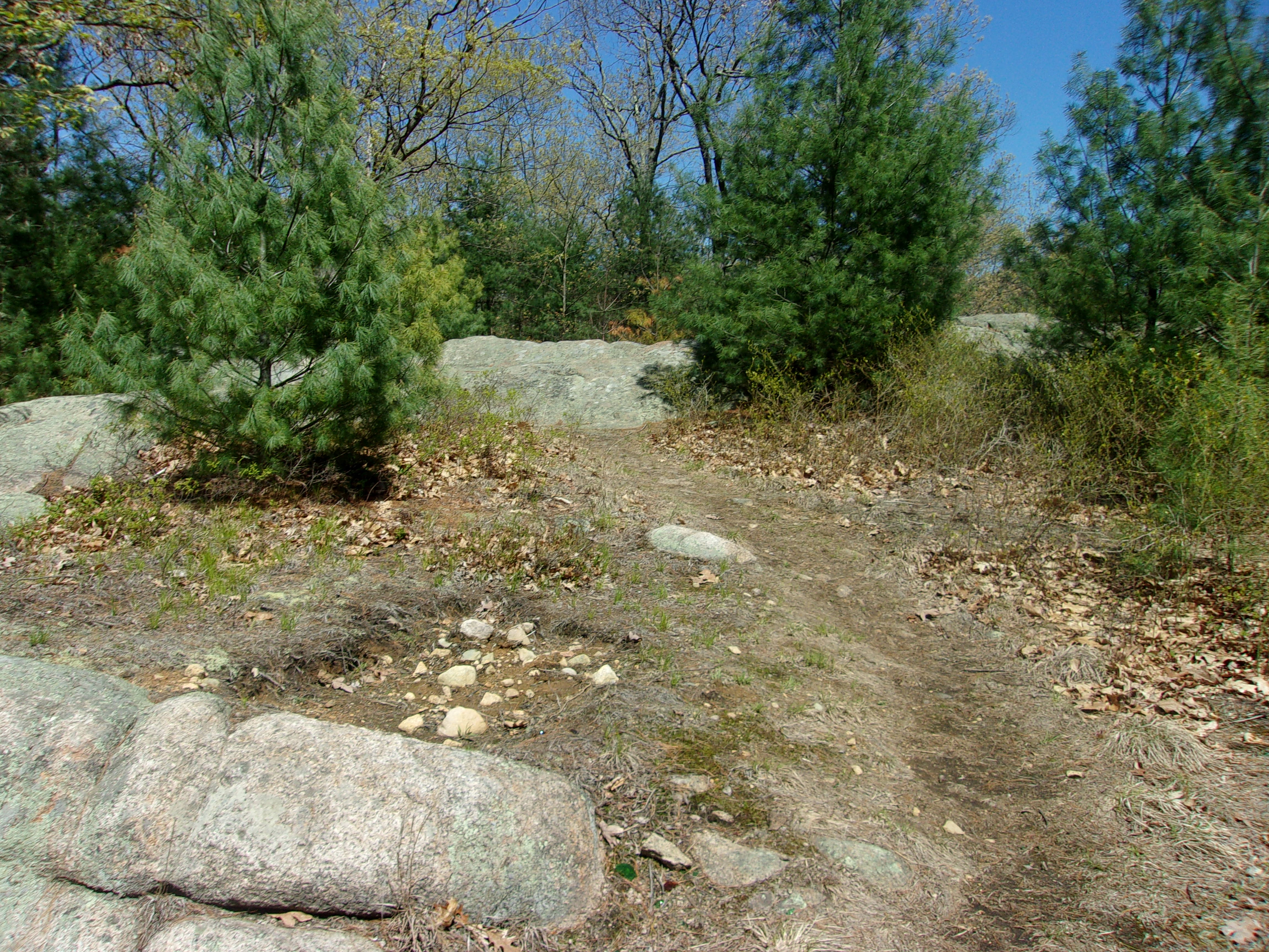
At .33 two trails lead to the left. One into the forest and one over
rocky ledges. The trail curves left and then right with yet another
narrow trail to the right.
The yellow loop trail now enters the forest again and soon after the water tower at the end of Lockewood Dr. is to the right.
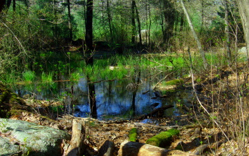
To the left a vernal pool looking lush in the spring with grasses growing out of it.
The trail turns narrow here as it winds its way through a large glacial rock area. Lots to explore here as another narrow trail runs to the right through another part of this area. Look carefully for the trail as it runs over rock while another trail leads to the left. Mistakenly went left here thinking it was an easier way through the rock, but the trail continues over the rock ledges. It runs downhill moderately, then climbs quickly up and down another rock.
At 1/2 mile another blue blazed trail cuts across the yellow loop trail. It now continues straight a bit more narrow and runs steeply downhill. The trail then turns left and becomes wide again. There is a trail that continues straight down another steep slope. Here there are signs of mountain bike use. Several trails loop around this lower area and are perfect for that activity!
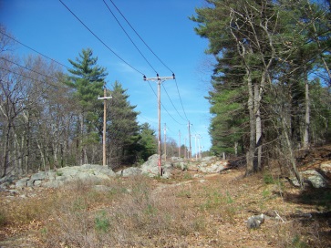 Older picture of the trail through the powerline that no longer has the lines running through.
The trail now curves to the right and shortly runs through the power line that no longer contain the lines. There is a blue blaze trail that leads left through the lines here. Continuing on the yellow loop there are a few trails leading to the right possibly back to the bike area. The trail curves left and enters the forest and another trail continues through the power line area. The yellow loop gets narrow again and rocky. There soon will be a slight descent less rock and the trail evens out.
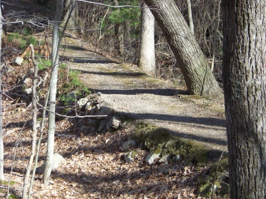
At .78 it passed through a rock wall after a slight climb and the trail divides.
Both ways are the yellow loop, the way to the right though meets downhill to the causeway and bridge over the unnamed but scenic stream.
This also leads to the high school entrance and immediately after the bridge is a trail to the left leading into the Arbor Hill Conservation Area of the Sanctuary.
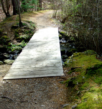
This bridge is a newer addition to the Sanctuary. Before there were just stepping stones to lead you across the stream. Nice to look at, but I hope it didn't chase the damselflies that I found here before.
If you came down to the bridge you will see the yellow loop connector that will bring you back up. If you continued straight at the top shortly you will meet the portion of the yellow loop that will meet with the trail up. Here the trail takes a left. A trail continues straight leading toward the Quarry Hills section of Avana apartment complex.
The trail becomes narrow and rocky and runs through an area with much rocky outcroppings. At just about the one mile mark a blue blaze trail leads to the right. Possibly the Mediterranean Dr. entrance. The trail passes through another rock wall.
The trail takes a slight uphill and continues rocky. Just after a blue blaze trail leads to the left.
The trail becomes wider and turns to the left as it passes private property with road maintenance equipment.
At 1.15 the trail meets the trailhead out to the parking lot. No blue blaze visible only the silver dots till you turn on to the trail and see the glacial depression once again.
The trail back makes the yellow dot loop hike come in at 1.25 miles. That is the shortest mileage here. With all the other trails and possible exploration I previously easily got over 3 miles in.
Highlights of Bradford Torrey Sanctuary
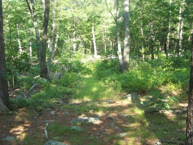 Grassy glen area
The grassy glen is found by exploring the blue blaze trail that cuts across the sanctuary.
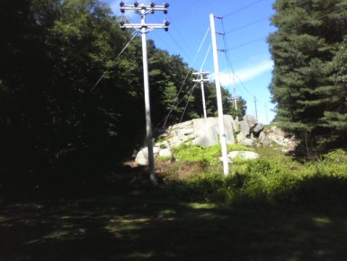
Wondering through the power line
trail you will find it interesting
but a more rugged hike.
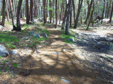
This is the trail that leads further into the boulder field near the water tower.
If your dog listens to your commands it would be a great place of play and exercise!
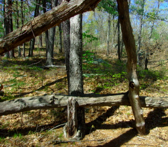
If you need a break there
are some good natural seating
areas along the trail
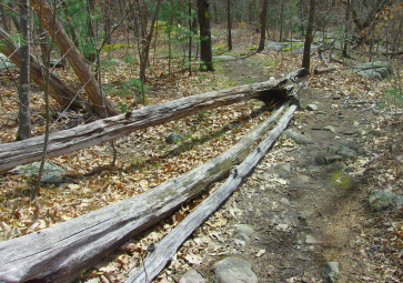
Like many conservation areas on the south shore, I found raspberry and blueberry bushes and grape vines. Raspberries usually in June, blueberries are ripening in July and August, grapes late August and September.
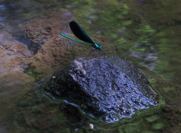
And previously dozens
of black winged
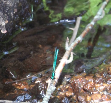
green bodied
damselfly
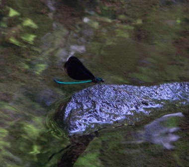
playing at
the brook
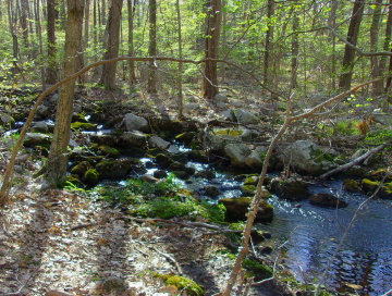
The damselflies previously were found playing at the stepping stones now replaced by the bridge over the stream.
If they moved on, possibly hiking down into Arbor Hill Conservation, on the trail just after the bridge, this will follow the stream and perhaps find them there. With more scenic views along the way!
- South Shore Hiking Trails ›
- Weymouth ›
- Bradford Torry Bird Sanctuary
Trail
Quick Facts
Directions:
from exit 38 off route 3 head south on route 18. Heading straight at the set of lights in the left lane just after Hunter Terrace will be the main trail head parking, Route18 is always heavy with traffic! Signal early!
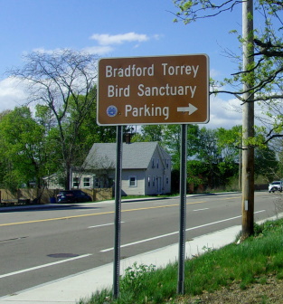
Parking:
Route 18 parking area is the main entrance although difficult to access during traffic. Room for several vehicles.
South Weymouth High School Entrance:
Continue on route !8 past the main entrance. At the next light go left on Park Ave. follow till almost to the next set of lights just before is the side entrance to South Weymouth High many vehicles.Take the first left for Lots D and E. The entrance can be seen at the edge of the parking area. During school hours it will be hard to find an open space here as it is faculty parking. There is a visitor parking area further away.
Mediterranean Drive:
When exiting the highway heading south immediately get in the far left lane to take a left on Middle St.
Go right at the Avana apartment complex. The road around is called Mediterranean Dr. About half way around on the right is the trailhead. There has been parking created for the trail. 8-10 vehicles look to fit here. Across from the trailhead is access to a large parking area behind the buildings.
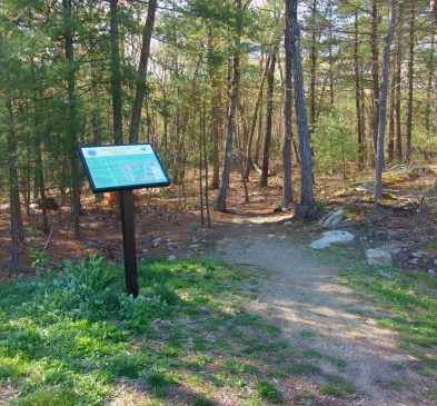
Tall Oaks:
This is also known as Arbor Hill. The section of Bradford Torrey Sanctuary this leads into is known as Arbor Hill Conservation Area.
This trail head is in another apartment complex found off Pleasant St on Tall Oaks Dr. at the end of the drive. Parking could be difficult at this location although a Saturday afternoon visit to the trailhead many spaces were open.
Use the same directions for the high school entrance but continue to the lights at Park Ave and Pleasant St and take a left. Tall Oaks will be the 4th left just before the overpass. Follow this to the very end you will find the trailhead on the left before the final turn into the end parking lot.
Lockewood Dr.
Although this is on the map I would consider it a foot traffic only entrance. It is located on Park Ave but parking looks to be discouraged here. Plenty of parking elsewhere!
Trail Time:
Light to moderate: mostly easy hike 1-3 miles
Difficulty:
Easy to moderate:
Most of the trails are wide and easy but there are areas with considerable rockiness and some good sized hills. Good footwear and walking stick suggested.
Water sources:
one unnamed brook
Other activities:
bird watching, partial bicycling, x country ski, snow shoe


New! Comments
Have your say about what you just read! Leave me a comment in the box below.