hiking trails of holbrook
Boundary Trail

The Boundary Trail is one of the hiking trails in the Holbrook town forest that starts at the Mann Entrance on Pine st in Holbrook.
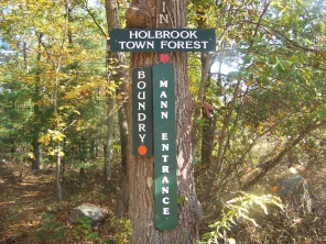
It is fairly long and may be the most interesting.
This trail can be a challenge to stay on though.
It is quite narrow in many areas and seems to be the least maintained of
hiking trails. Many areas the orange circles that mark the trail are
either considerably faded or on trees where the mark has worn away
leaving only an outline.
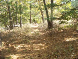
The first part of the trail runs north with the Wiggins Trail through a narrow strip of forest.
At the power line the two hiking trails run along together for a short part of the trail.
Then the two separate making it obvious that the Wiggins continues into
the forest as another sign that marks the trail is posted on a tree.
There are no signs or obvious markings for the boundary trail here
leaving one to assume the trail continues with the power line.

The path of the Boundary trail becomes very faint here.
There are no markings till the boundary trail loops into the forest
where a small cairn with it's trail blaze faintly painted on top point
the way.
Some trail work is needed here!!
Recent work on the power line
have made things worse, cut trees
covering any semblance of a trail.
Once in the forest the trail is pleasant enough
but keeping on it (at least in late fall or any leaf less time is a challenge).
Your attention will get taken away by a point further down the trail
that seems to run on top of a hill. You will almost certainly not notice
that a junction of the Elfin Trail enters from the left and Elfin Pond
is also comes into sight on the left.
At this point the trail runs with Elfin Trail for a time. Again
if you are not paying attention you will miss the Boundary Trail taking a
right away from Elfin Pond and off into the forest again.
There seems to be some sign confusion in the area. You will most likely see a sign that claims that this trail is the Sawyer Trail but that trail is actually down the Elfin Trail further and accessed by a side "leg"trail of the Elfin Trail. It is at this sign that the Boundary Trail takes its right.
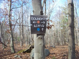
It eventually leads down to an access trail
that can be taken to the Long Trail
or you can continue on.

Further down this portion you will find yourself doing a bit of climbing (slight).
Again the trail gets narrow and faint at times.
The arrow in this picture is pointing to a blaze on a very small tree.
The blaze has faded and become very faint. The trail here also becomes
very narrow.
The trail seems to end at the power lines like other trails of the Holbrook town forest.
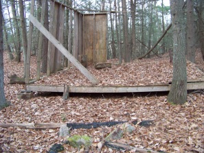
Yet there seems to be an older section of this trail that will take you down a hill.
It will then continue past what looks possibly like a practice session of some vocational students framing and building job.
If the sides were taken down it could be a pretty nice tent platform.
This portion of the trail makes a loop back to an earlier portion of the trail which can be followed back out to the Long Trail.
This trail is mostly dry and fairly easy to hike.
The real challenge is staying on it.
- South Shore Hiking Trails ›
- Holbrook ›
- Boundary Trail
Trail
Quick Facts
Directions:
from Boston take route 93 south and route 3 at split. Take exit 38 route 18 south. Right at next intersection onto West st. This becomes Grove at Braintree line. Follow til intersection with Liberty st. This becomes Pine St at Holbrook line. Left at Forest St and right on Park St. to end.
Parking:
2-3 cars at end of Park St.
Trail Time:
Light-Moderate,
1 hour
Difficulty:
easy;
hard to follow at times
..
Water sources:
only in spring
Other activities:
snow shoeing,
New! Comments
Have your say about what you just read! Leave me a comment in the box below.