hiking trails of weymouth
Great Pond Trail

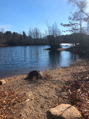
The Great Pond Trail in Weymouth was created using an existing network of trails along the Great Pond Reservoir. The trail also connects two neighborhood parks Gifford Playground and Negus Park.
Both parks have sufficient parking. Gifford Playground has a small but newer playground including picnic tables and trash barrels. In warmer months portable outhouses.
Along this trail there are many side trails leading to spectacular views of the water.
From Gifford Park the trail leaves at the right side corner of the field through an opening in the fence. Previously unmarked but now greets the visitor with a sign including a map.
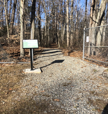
The Great Pond Trail begins wide with gravel but soon turns to forest floor.
Shortly the trail makes an intersect and turns right.
A trail leading to the left will runs for a bit but soon fades away.
On the Great Pond trail leading to the right the trail gently leads downhill and at .10 it crosses over a newer boardwalk easing you over a small stream that appears more like wetland in winter and spring.
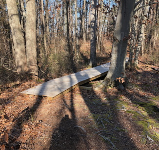
Shortly after this, another boardwalk appears that replaces an older makeshift crossing.
Soon after this second boardwalk the trail splits.
The great pond trail goes straight and another trail goes to the left. The other trail going left will bring you to the water.
This trail description follows the established trail marked by yellow rectangles and town conservation badges then uses the alternate way on the return trip.
The main trail continues straight wide and rocky and will climb slightly.
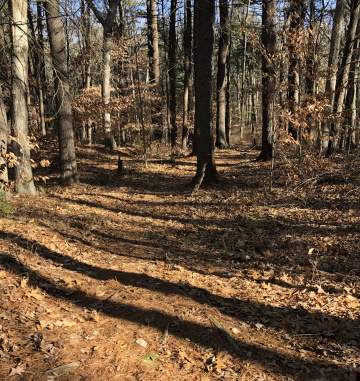
This side of the hiking trails bring you closer to the residential portion of the area.
The hiking trail continues slightly downhill curves and narrows.
At .28 the cart path goes straight into private property and the yellow blazed Great Pond Trail takes a left marking the way with Weymouth open space medallions.
The Great Pond Trail becomes meandering and many smaller trails will lead off to the left and right.
This more narrow portion of the trail will come upon a series of tree limbs that line the way.
At .33 the trail turns left and widens once again.
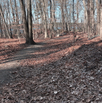
The trail will pass a large boulder
and then Great Pond will come into
view with more boulders on either
side of the trail.
At .41 mile the trail will intersect the alternate trail along the water.
The Great Pond Trail curves to the right and a short path will lead down to the water with a small beach.
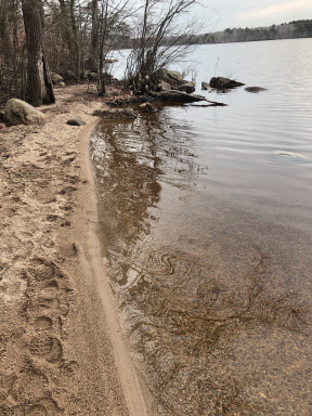
This is a public drinking water supply so although it is a beach there is no swimming, fishing or boating allowed here.
The trail curves to the right here.
Continuing on the trail it will come upon the Swan Ave entrance. The trail will climb almost unnoticeable.
At .63 a road like trail runs to the right and afterward several trails leading to the left to the waters edge.
The trail to the right will lead into a neighborhood cemetery but is also an alternate trail to the opposite end of Negus Park.
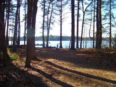
Continuing on the Great
Pond Trail, there will be
another gentle descent.
At .78 of the journey the
trail will let out to a
beautiful open grove
that has unfortunately
been abused by night
visitors.
There is another neighborhood trail to the right.
The Great Pond trail continues straight and will narrow.
Soon slabs of cement on the trail will reveal a bit of past.
This pond has been looked to since the mid 1800's as a source of water for the town. It also was a source of ice in the years before refrigeration.
Soon after, the Great Pond Trail splits and appears to lead uphill.
The trail actually curves left and runs close to the water.
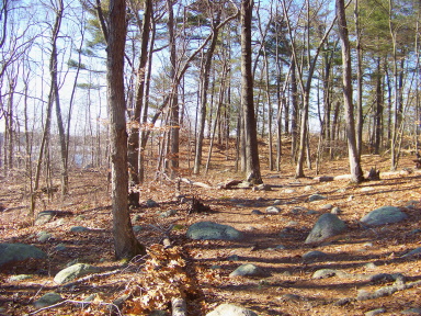
The trail uphill is an alternate way.
If you follow to the top of the hill
continue straight to
connect with the trail
leading out of Negus
Park.
Head left here to reconnect with The Great Pond Trail.
After this alternate way split the trail runs through an area littered with a bit of glacial till and to the left down below at the water a peninsula circling a lagoon juts out into the water.
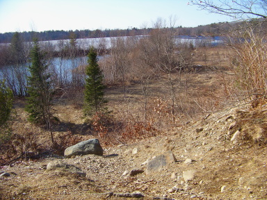
The trail curves left and intersects another trail that runs down to meet this peninsula.
The Great Pond Trail continues straight now leading to the right and Negus Park comes into sight to the right.
Natural inclination draws you to the right toward the park but the trail continues straight and leads along a chain link fence.
The fence soon ends and at .90 and intersects with a side trail leading down to the water and another trail below. These last two trails to the left are quite steep.
Here the previous alternate way trail connects to the right.
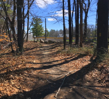
At just over one mile the link trail to Negus Park leads to the right.
Here you will find more trash barrels, ball fields, a concession stand in the summer and a bit of playground behind it.
Past these will be the alternate trail back if you want a quicker hike.
Back on the trail and guide through the area,
straight ahead a preexisting trail continues straight.
Following this there will be another intersect with a street to the right and a trail to the water to the left. This left will be used to return and explore!
The trail heading straight continues till it reaches the water department treatment access road where there will be no trespassing signs.
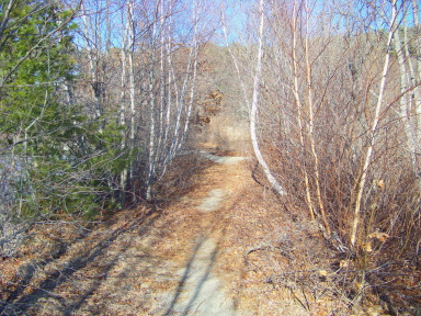
On the return trip the wide path/road down to the lagoon/peninsula was used.
At the bottom of the hill go right.
There is a bit of road that continues toward the water department area and possibly another path that will connect to another area road.
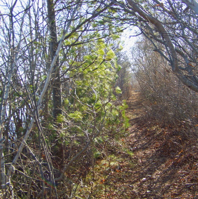
Going left on a sandy trail that circles the lagoon was more interesting.
Soon it comes to a corner on the lagoon at 1.14 and another trail leading right toward the water plant.
The narrow sandy trail goes left between the far end of the Lagoon and the pond edge.
There will be several openings to look out over the pond.
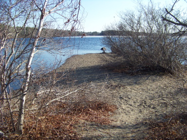
Following around at the furthest point the sandy trail will continue out onto a peninsula at 1.20 that extends out further into the water.
This narrow trail will lead out to a rocky open “beach”.
Worth the explore!
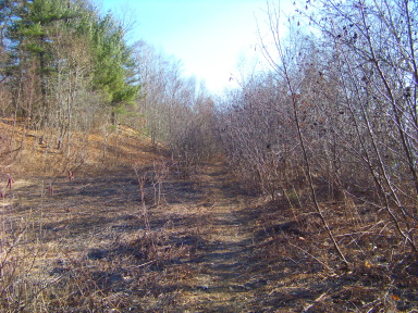
The trail that circles the lagoon heads to the left.
Once out from the lagoon head right.
This not as narrow trail along the water will lead below the chain link fence passed on the initial hike out.
At 1.35 (or more if you explored) the trail comes to another little “beach” and peninsula with a trail out along it.
This hike back is full of little beach and peninsula exploration!
From here it appears the trail continues on the beach but does not. Take a left and follow the main trail to the right and back for a bit.
At 1.48 you will return to the grove.
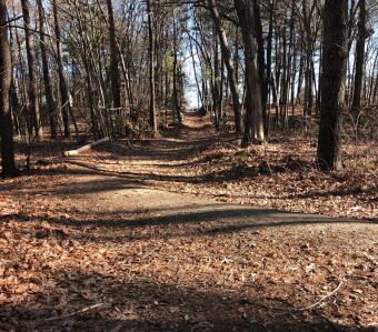
Continuing on along this section back along the main trail, the trails that you may have not explored along the way down you can visit to extend the hike.
There will be several trails out to points on the water.
Follow the main trail till it takes the wide sweeping turn to the left.
You will have passed the Negus Park connecting trail at 1.60 and the Swan Ave entrance at 1.69
To the right will be a more narrow trail along the water at 1.75.
This sandy hiking trail is full of root and rock and leads out to another peninsula trail at an iron post in the ground that can be explored.
The trail continues on straight and wider with gravel trails leading to the left.
At just under two miles another peninsula trail leads right and the main trail curves left.
A few steps later a more narrow trail leads right just after the second large boulder.
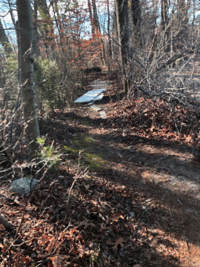
This leads over some makeshift planking and then runs moderately uphill.
At the top more water views then leads downhill and curves sharply to the right.
At 2.07 a small moss covered hill appears to the right with a path leading to the top.
If you follow the narrow trail up it leads over and around the hill.
Just after, the trail intersects. Go left for a quicker way out or go to the soft right for a bit longer trail out to the Great Pond Trail.
Along this right will be another trail leading to the right. It ends at the waters edge but attempts to make a crossing here can be seen. Across the water a hill with open looking forest is visible.
A boardwalk across this would make a great addition to the area!
Continuing on the trail, once out go right and the two sets of boardwalks will be in sight.
Back to the playground will make 2.25 miles!
With all the possible exploration this usually ends up being a 3-4 mile hike.
Highlights of The Great Pond Trail
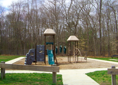 Part of the playground at Gifford Park
The playgrounds! A good start to any hike with younger children.
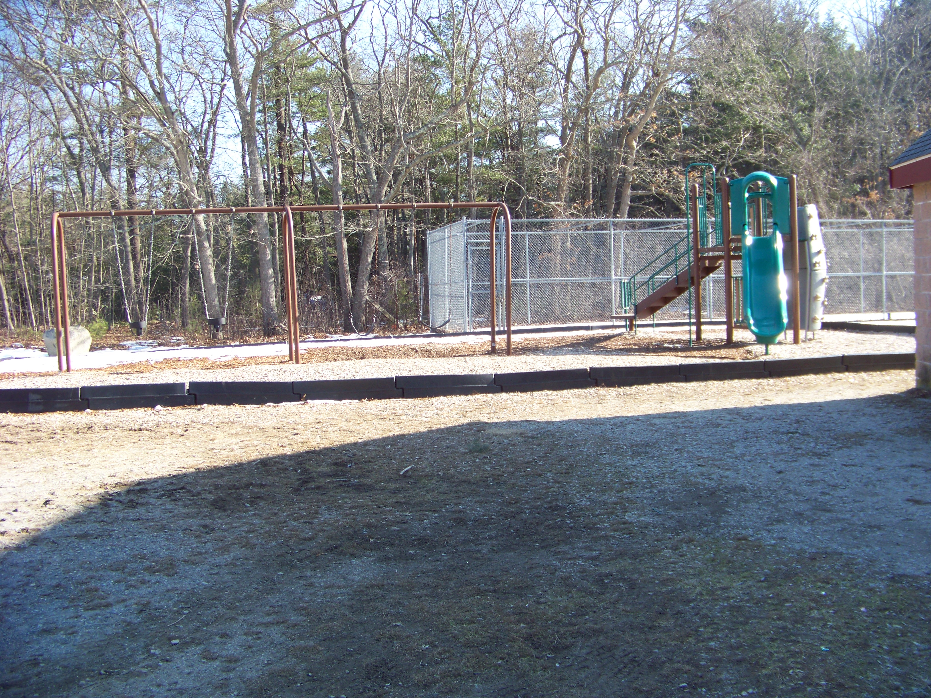 The Negus Park Playground is found behind the concession stand.
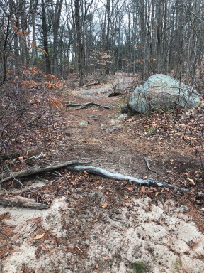 The sandy trail on the return hike along Great Pond.
The numerous water views that keep you looking toward the shores of the Great Pond.
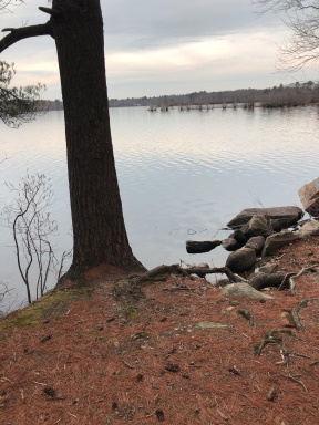
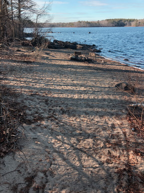 The little beaches along Great Pond make you want to bring a chair and soak up the sun!
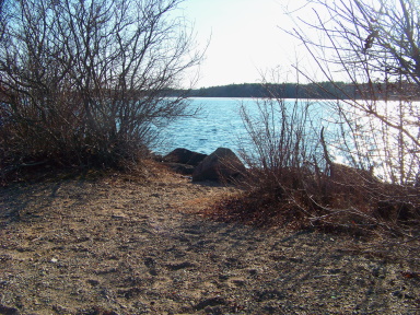 Water view on the sandy trail out to the peninsula around the lagoon.
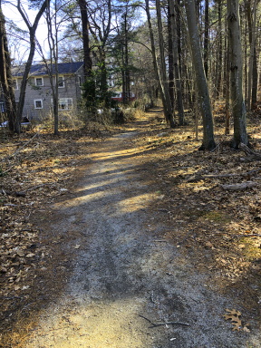 Don't forget to explore the trail leading out of Negus Park just beyond the playground.
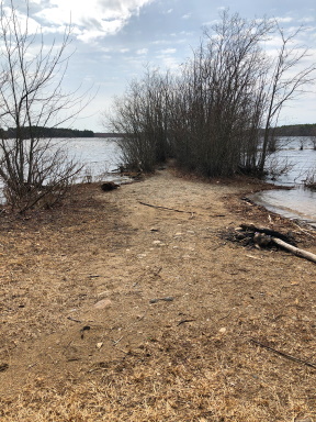 One of the many peninsula's with a trail leading out on the water.
So many more sights here you just have to visit yourself to see!
Trail
Quick Facts
Directions:
From route 3 exit 36 go south on route 18. At the 4th set of lights at Pond St. go right. Continue straight at the light at Hollis St. Follow down to the right on Thicket St. ( A well used right with an island divider). Gifford Park is approx. 1/3 mile on right.
Parking:
Gifford Park approximately 20 spaces.
Negus Park is off Pond St behind the Fulton School Residences and numerous spaces there.
Trail Time:
Variable
So many options!
Great Pond Trail is just over one mile.
Generally 2 mile hike but exploring can lead to 3 even 4 miles.
smaller loops can also be made.
Difficulty:
Easy
Water Sources:
Great Pond and small stream near Gifford Park
Great Pond Trail Map


New! Comments
Have your say about what you just read! Leave me a comment in the box below.